English

Equator
The Equator is an imaginary line on the Earth's surface, equidistant from the North and South Poles…
Reads at Grades 3–5 Listens at Grades 1–5
 Screen-free speaker. Built for your kids.
No card, no commitment. One email when there is real news, and one click to stop.
Print & create
Answer keys·No prep·Free with an account
28 worksheets · answer keys · full story · quiz · Ages 8-10 · CEFR B1
Plus adds 102,000+ more stories in 27 languages, audio for every one, and printables for all of them.
Just want Equator?
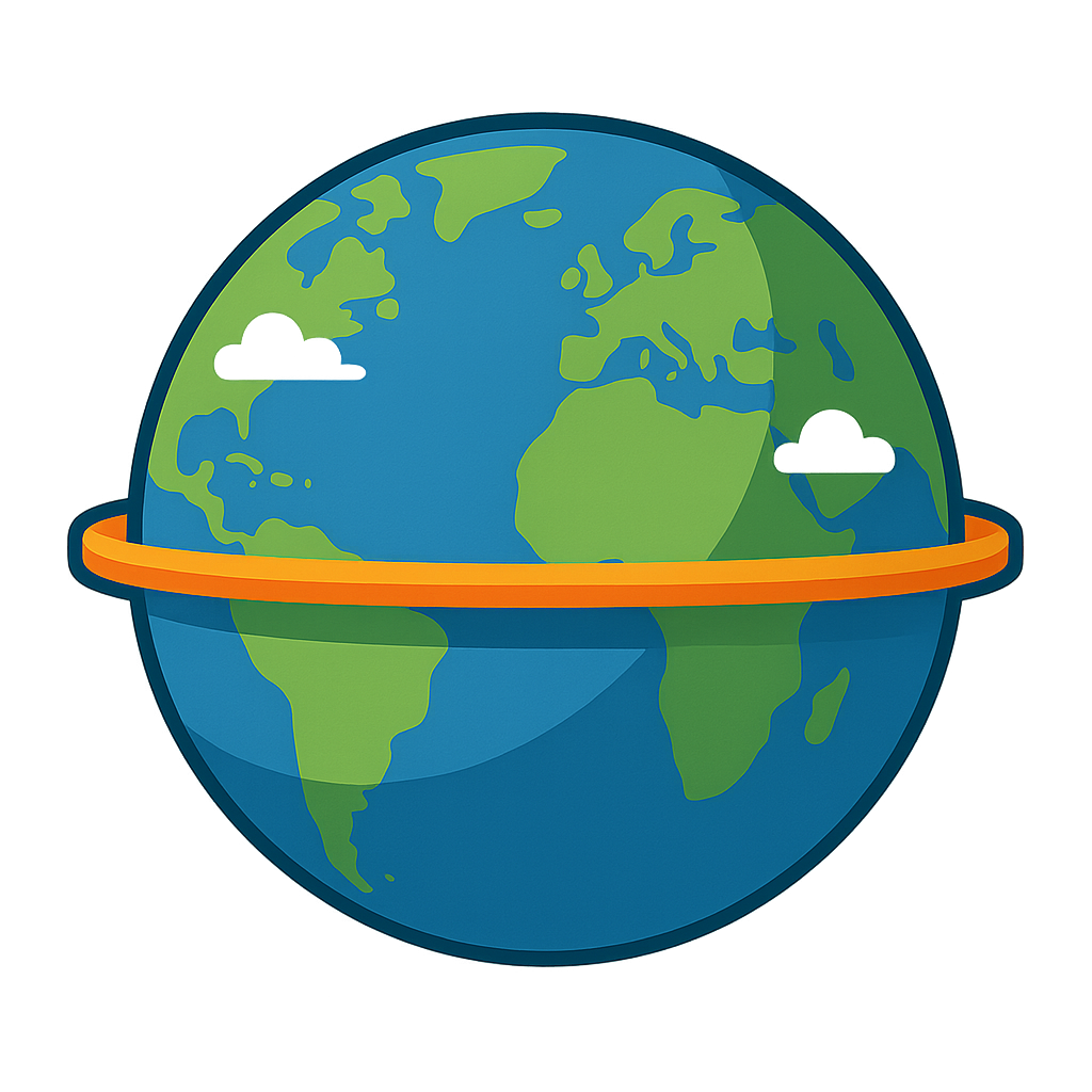
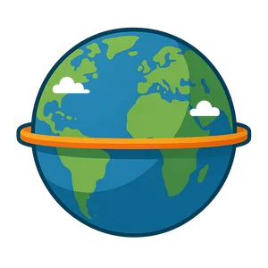
Imagine a warm, invisible hug for the whole world. That’s me. I wrap myself right around the Earth’s belly, a perfect circle stretching for almost 25,000 miles. You can’t see me or touch me, but you can feel my presence. Along my path, the sun is my closest friend, hanging almost directly overhead at noon every single day. This friendship keeps my lands warm and toasty all year long. I am home to the most incredible, lush green rainforests you can dream of, teeming with colorful toucans, chattering monkeys, and sleek jaguars. Can you picture a world where the day and night are almost always perfect equals. I give the places I touch about 12 hours of sunshine and 12 hours of night, a steady, dependable rhythm. I am a cozy belt of warmth and balance, holding our spinning planet together as it journeys through space.
So, who am I. I am the Equator. And while you can’t trip over me on a walk, I am a very real and very important idea that people have been thinking about for thousands of years. My story begins in ancient Greece, long before anyone had ever sailed all the way around the world. Around the 6th century BCE, a thinker named Parmenides first suggested that the Earth was a sphere. If it was a sphere, he reasoned, it must have different climate zones, and there had to be an incredibly hot zone right at its center. He was thinking of me. But it was a brilliant librarian named Eratosthenes who truly brought me into focus. Around the year 240 BCE, in the great library of Alexandria in Egypt, he performed an amazing experiment. He had heard that on a certain day in a city to the south, the sun shone directly down a deep well, casting no shadow. But in his own city on that same day, a tall stick cast a shadow. By measuring the shadow’s angle and knowing the distance between the two cities, he used some very clever math to calculate the size of the entire Earth. His discovery helped prove I was real and gave people the tools to put me on a map. Centuries later, brave sailors on creaking wooden ships would have huge celebrations when they crossed my invisible line, marking the moment they passed into a new half of the world.
The World's Warmest Belt
Imagine a warm, invisible hug for the whole world. That’s me. I wrap myself right around the Earth’s belly, a perfect circle stretching for almost 25,000 miles. You can’t see me or touch me, but you can feel my presence. Along my path, the sun is my closest friend, hanging almost directly overhead at noon every single day. This friendship keeps my lands warm and toasty all year long. I am home to the most incredible, lush green rainforests you can dream of, teeming with colorful toucans, chattering monkeys, and sleek jaguars. Can you picture a world where the day and night are almost always perfect equals. I give the places I touch about 12 hours of sunshine and 12 hours of night, a steady, dependable rhythm. I am a cozy belt of warmth and balance, holding our spinning planet together as it journeys through space.
So, who am I. I am the Equator. And while you can’t trip over me on a walk, I am a very real and very important idea that people have been thinking about for thousands of years. My story begins in ancient Greece, long before anyone had ever sailed all the way around the world. Around the 6th century BCE, a thinker named Parmenides first suggested that the Earth was a sphere. If it was a sphere, he reasoned, it must have different climate zones, and there had to be an incredibly hot zone right at its center. He was thinking of me. But it was a brilliant librarian named Eratosthenes who truly brought me into focus. Around the year 240 BCE, in the great library of Alexandria in Egypt, he performed an amazing experiment. He had heard that on a certain day in a city to the south, the sun shone directly down a deep well, casting no shadow. But in his own city on that same day, a tall stick cast a shadow. By measuring the shadow’s angle and knowing the distance between the two cities, he used some very clever math to calculate the size of the entire Earth. His discovery helped prove I was real and gave people the tools to put me on a map. Centuries later, brave sailors on creaking wooden ships would have huge celebrations when they crossed my invisible line, marking the moment they passed into a new half of the world.
Today, my job is more important than ever. On every globe in your classroom and every map on a screen, I am the main starting line. I am 0 degrees latitude. Everything north of me is called the Northern Hemisphere, and everything south of me is the Southern Hemisphere. I am your guide, the line that helps everyone understand where they are on our big planet. I pass through 13 amazing countries, each one special. My journey takes me through the green rainforests of Ecuador and Brazil in South America, across the savannas of Kenya and Gabon in Africa, and over the beautiful islands of Indonesia in Asia. Though I may be an imaginary line, I connect very real people, diverse cultures, and incredible animals. I am a constant reminder that we all share one beautiful, round planet, held together in perfect balance and spinning together in the warm sunshine.
Wow facts
About
The Equator is an imaginary line on the Earth's surface, equidistant from the North and South Poles, that divides the planet into the Northern and Southern Hemispheres.
Take a Quiz
Question 1 of 5
In the story, the Equator is described as a 'cozy belt holding the world together.' What does this comparison mean?
Explore next

Want to do even more?
Go beyond exploring. Unlock tools that turn every story into real learning.
Storypie Plus for families
Full stories, quizzes, and printables. Nights and car rides, sorted.
- Unlimited audio stories
- Create Mode: your child stars in the story
- Offline downloads
- Printable worksheets & coloring pages

Why Storypie for Schools
Students engaged. Prep in seconds. Evenings back to you.
- Worksheets & Quizzes
- Classroom Management
- Formative Assessment
- Custom Curriculum & Lesson Plans
- 27 Languages
Why Storypie for Homeschool
Curriculum done. They'll ask for more. Hours back in your day.
- Worksheet Generator
- First-Person Audio Stories
- Built-in Comprehension Quizzes
- Custom Curriculum & Lesson Plans
- Print & Go Activities